


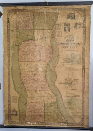
1852 Topographical Wall Map of Seneca County with Cayuga Lake & Seneca Lake

$974.00
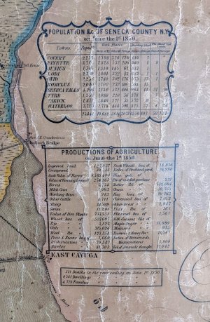
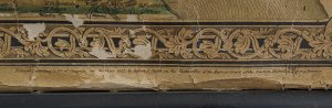
1852 Topographical Wall Map of Seneca County New York. Made for J. Delafield Esqr. Pres.Ag. Soc. by Wm T Gibson, 1852, hand colored, lacquered, linen backed. Extremely detailed, shows farm lines, owner names farm names, buildings, towns, roads, and historical places with information about population, libraries, schools, population and agricultural production. Included are the towns of Covert, Fayette, Junius, Lodi, Ovid, Romulus, Seneca Falls, Tyre, Varick and Waterloo. Shows the Finger Lakes of Cayuga and Seneca. Map measures approx. 55″ x 38″, backed with linen, Mounted to wood rods, top and bottom. Entered according to act of Congress in the year 1852 by Robert P. Smith in the clerks office of the District Court of the Eastern District of Pennsylvania. Shows nicely with typical signs of age and wear, there are several tears and a small hole along the top, a few flaked off spaces along the bottom and cracks and wrinkles through out. Map is clear and easy to read. Hand coloring has held up very well.
This is an antique item being sold as is. Please see photos as part of the full description. Contact me with any questions. Pick up in Trumansburg, NY or shipped by arrangement.
Out of stock
Related products