")
")
")

")
")
")
")

")

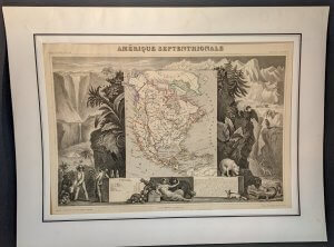
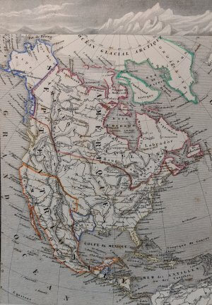

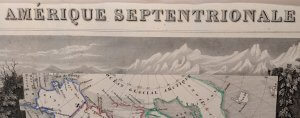
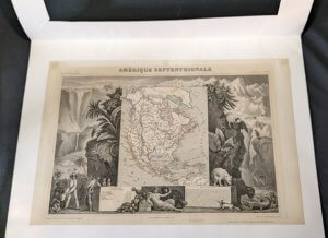
Amerique Septrionale Map from Atlas Universal Illustre c. 1845


$325.00
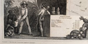
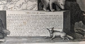
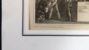
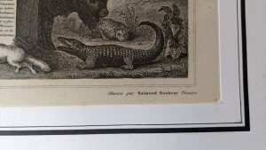
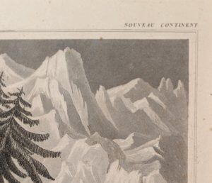
“Amerique Septentrionale” – steel engraving map of North America with hand coloring. Cartographer: Victor Levasseur (French, 1800-1870). Printer: Joseph Rose Lemercier (French, 1803-1887). Issued in Paris, ca. 1845. From the Atlas Universel Ilustre Map of North America, created following the Louisiana Purchase and prior to the statehood of Texas. The map is situated in the center and highlighted with hand coloring. In addition, it is surrounded by stunning vignettes of native flora and fauna as well as a meeting of a European with indigenous peoples created by artist Raimond Bonheur (French, b. 1796). The map also includes a descriptions, in French, of the populations of various regions as well as a description of the decorative imagery – decorated with a central image of a female allegorical figure symbolizing America who leans on a bale of cotton surrounded by various fruits, with her left hand raised to pet a large dog beside her.
Size: 13″ L x 20″
Condition: Excellent condition with strong impression, bright, clean paper. Minimal signs of age and wear including some light foxing.
Framing: Unframed, matted
FREE SHIPPING
Vintage item being sold “as is”. Please see photos for more detail and contact me with any questions.
1 in stock
Related products